A hurricane could be in the Caribbean next week. What the forecast models show about its threat to US
Published in News & Features
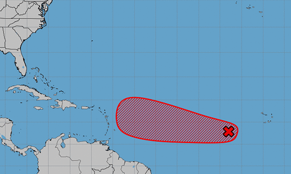
Confidence is increasing that a tropical system — possibly even a hurricane — could form near the Caribbean islands next week and track west in the general direction of Florida or elsewhere on the U.S. coast.
As of Thursday morning, it’s just a rainstorm in the east-central Atlantic moving slowly to the west through dry air. But the National Hurricane Center gives it a high chance of development in the next seven days as it moves closer to the Caribbean.
By Wednesday or Thursday, it could be Tropical Storm or Hurricane Gabrielle near the northeast Caribbean, said Alex DaSilva, lead hurricane expert for AccuWeather.
From there, the forecast is far less clear: Will Gabrielle track west toward the U.S. or make a turn to the north as Hurricane Erin did in late August?
“That’s the million-dollar question,” DaSilva said. “The stronger it’s able to get, the better the chance it would be able to turn out to sea and find a weakness in the Bermuda high, which is to the north. And then that would steer it away from the United States.”
But DaSilva cautioned that the system has not developed yet. And until it has a defined center, long-range forecasts are subject to big changes.
“The United States absolutely needs to be on guard and keeping a very close on this because there are scenarios where this could come a little bit farther to the west,” DaSilva said. “Right now, I think the most likely scenario is that it does turn away from the United States. Maybe it gets close to the (Caribbean) islands or even through the islands, but then it begins to make its turn out to sea.”
Any potential impact on the U.S. from this system is still more than 10 days away, DaSilva said, leaving plenty of time for forecasts to change.
“But I think this should be a good wake-up call for people because the tropics are going to get very active here, we believe,” DaSilva said. “This should be a very second-half loaded season similar to what we saw in 2024. This is only the first of, I think, many tropical waves that we’re going to be watching coming across the Atlantic.”
DaSilva said another wave is already poised to move into the Atlantic behind the current one, possibly late next week.
Forecasters also expect activity to pick up later in September in the Gulf, which has been unusually quiet so far this hurricane season.
That’s a particular concern to experts, who say the lack of tropical systems — which can churn deep, cooler water the surface — has pushed water temperatures to record levels for this time of year.
Surface temperatures Thursday were at the warmest on record for this date, DaSilva said. And ocean heat content in the Gulf, which indicates how much energy is in the warm water, is at the second-highest levels after 2024.
And that means explosive development of any tropical system that reaches the Gulf.
“There’s a lot of energy in the Gulf,” DaSilva said. “And, of course, in 2024 we saw Milton and Helene really rapidly intensify in the Gulf. So that’s the concern here as we go into the second half of September and into October as well, is that if anything is able to get in there, it’s likely that it would rapidly intensify.”
The tropical hazard outlook for September, issued by NOAA’s Climate Prediction Center this week, indicates that forecasters expect the warmer waters to increase the chances of tropical activity in the Gulf next week. The second half of hurricane season typically sees more activity in the Caribbean and Gulf than the first half.
By the week of Sept. 17, the threat of potential tropical activity in the central Atlantic and eastern Caribbean increases substantially. September and October are historically the most active months of the Atlantic hurricane season.
_____
©2025 South Florida Sun-Sentinel. Visit sun-sentinel.com. Distributed by Tribune Content Agency, LLC.


Comments